Project Updates
→ Barge Disposal Plume Tracking Using Multibeam Water Column Data
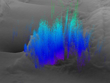
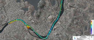
CR conducted a multibeam bathymetric survey of a CT offshore disposal site and tested our Reson systems ability to track a barge disposal plume using water column data. The test was successful and allowed determination of material settlement time and lateral migration. We anticipate refining water column survey and processing methods and applying water column data in other monitoring surveys.
→ Portland Harbor Mapping and Sediment Sampling
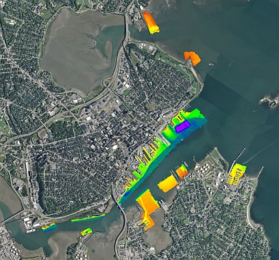
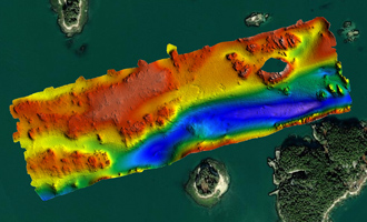
CR conducted multibeam, side scan sonar and magnetic surveys and sediment core sampling in Portland Harbor, Maine to support dredge feasibility studies. Surveys were conducted using CR’s survey vessel Cyprinodon and sampling vessel Lophius. The hydrographic survey covered approximately 301 acres, much in very shallow waters.
→ R/V Cyprinodon LiDAR System Testing Completed
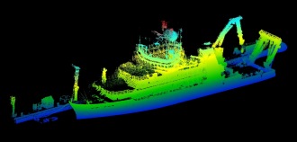
Above: LiDAR Elevation Point Cloud of the R/V Neil Armstrong Alongside the Iselin Dock and Village of Woods Hole.
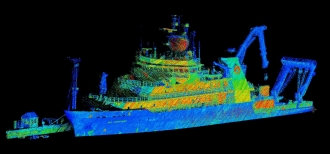
Above: R/V Neil Armstrong LiDAR Intensity
CR installed a Velodyne LiDAR system atop the pilot house of the R/V Cyprinodon. The system was successfully calibrated and tested. Testing included mapping the entire shoreline of the Village of Woods Hole and we were fortunate to scan the R/V Neil Armstrong tied up on the Iselin Dock. The LiDAR system will augment our multibeam sonar systems for mapping structures above the water line, and will be especially effective for bridge and pier inspections. LiDAR intensity was sufficiently sensitive to detect the vessel's markings.
→ Photogrammetric Wreck Documentation
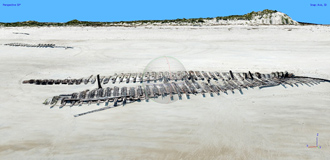
CR collaborated with the Massachusetts Board of Underwater Archaeological Resources and Trustees of Reservations (MBUAR) in an effort to document portions of Ada K Damon, wrecked off Ipswich, MA in 1909.
The entire beach around the wreckage was surveyed using a sUAV (drone) and a robust 3D photogrammetric model of the debris was constructed which facilitated archaelologist's detailed documentation of the wreckage.
Details regarding the history of the wreck and the investigation are available here: Storm Surge Washes Away 110-year-old Shipwreck on Crane Beach.
→ Search for the HMS Gaspee
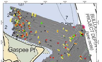
CR conducted geophysical surveys of approximately 100 acres of Narragansett Bay around Gaspee Point in Warwick, Rhode Island for RIMAPS. Surveys included side-scan sonar, sub-bottom sonar, and magnetometry.
The purpose of the surveys was to identify features potentially associated with the wreck of the HMS Gaspee which ran aground on Gaspee Point (formerly Namquid Point) in 1772. Following the grounding the Gaspee was set afire.
Details regarding the history of the Gaspee and the investigation are available here: Search for HMS Gaspee involves hours of going back and forth bottom of Narragansett Bay.
→ R/V Encourager Outfitted with Multibeam Sonar
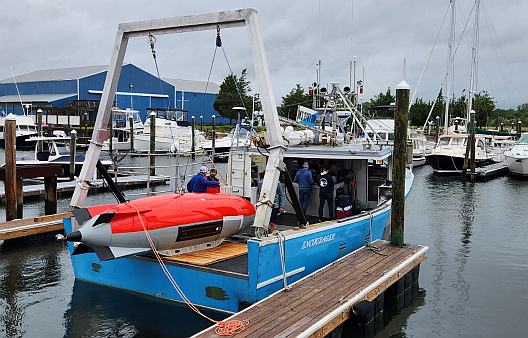
CR installed our Teledyne Reson T20R sonar and IxBlue Octans V MRU on the 48-foot R/V Encourager, based out of New Bedford MA.
CR had previously employed the vessel for side scan and magnetic surveys in support of offshore wind projects.
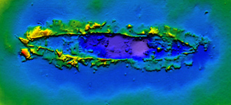
The multibeam system was successfully calibrated and used to survey the wreck of the Yankee, located at an approximately 50 ft depth in Buzzards Bay.
Data quality was excellent and without discernable motion artifacts.
We look forward to conducting many offshore surveys with the Encourager.
→ High Resolution Bathymetric Mapping of West Falmouth Harbor, MA
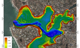
CR conducted a bathymetric survey of West Falmouth Harbor for the Buzzards Bay Coalition between February 23 and April 5, 2022.
Survey components included multibeam and single beam sounding systems.
Data are being used by the USGS to refine volumetric and flushing calculations for the harbor.
→ Multibeam Mapping of the Massachusetts Bay Disposal Site & Disposal Sites in Downeast Maine
CR conducted multibeam bathymetric, backscatter and side scan sonar surveys of the Massachusetts Bay Disposal Site and three historic disposal Sites for ACOE and EPA.
Our underwater video grab system and towed underwater video sled were used to assess bottom conditions.
CR also processed and analyzed high resolution synthetic aperture sonar data collected using an AUV at the MBDS.
We're grateful that the prime contractors for ACOE and EPA continue to select CR Environmental for mapping and sampling efforts.
→ NOAA RNC Tile Service Displays First ENC-only Product
CR is proud to have contributed to this important mapping effort.
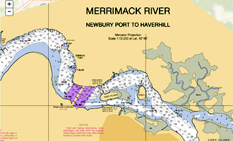
The lower Merrimack River is a beautiful natural resource with an important and economically significant history.
Read here: NOAA RNC Tile Service displays first ENC-only product .
→ Collaborative Effort to Create New Nautical Chart Returns Recreational Boaters to Haverhill, MA
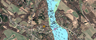
Working under contract to the Greater Haverhill Foundation, CR performed bathymetric and side scan sonar surveys of an approximately eight mile reach of the Merrimack River between Merrimac and Haverhill, Massachusetts in 2014.
NOAA's Office of Coast Survey merged the 2014 data with ACOE multibeam data (2004) and NOAA LiDAR data to construct a 1:12,000 chart of the river from Newburyport to downtown Haverhill.
We're proud to have contributed to this economically important charting effort.


