Geophysical Surveys
CR has conducted over 300 marine and freshwater multiparameter geophysical surveys in support of engineering, archaeological, environmental remediation, and marine construction projects.
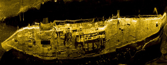
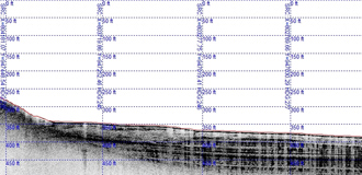
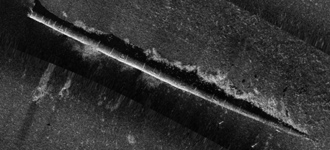
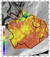
Most projects are designed to facilitate simultaneous acquisition of high-resolution bathymetry and data from other instruments (sub-bottom sonar, magnetics, side scan). We maintain a comprehensive pool of remote sensing and navigation systems, including sub-bottom profilers, side scan sonar systems, magnetometers, acoustic Doppler current profilers, and DGPS/RTK DGPS units.
All data products are ESRI GIS and CAD compatible. We also offer processing and analysis services for geophysical and hydrographic data collected by other parties.
Recent Geophysical Survey project experience is listed below:
→ Site Characterization, Environmental Remediation Feasibility, and FERC Investigations
- Multiparameter surveys of the Thames River, New London, CT
- CERCLA Site Characterizations, Hudson River, Albany, NY
- Superfund Remediation Feasibility Studies, New Bedford Harbor, MA
→ Alternative Energy Investigations
- Bay of Fundy Tidal Power Generation FERC Licensing Surveys, Eastport, ME
- East River Tidal Power Generation FERC Licensing Surveys, New York City, NY
- Offshore Wind Power Site Geological and Biological Characterizations, Block Island, RI
→ Cable Crossing and Pipeline Surveys
- Multiparameter surveys of proposed cable routes between Marthas Vineyard and Falmouth, MA
- Neptune LNG Pipeline Monitoring Surveys, 2008-2011, Massachusetts Bay, MA
- Oil and Gas Pipeline Mapping, Gulf of Paria, Republic of Trinidad and Tobago
- Fiber Optic Communications Cable Permit Planning Survey/EIR Support Survey, Vineyard Sound, MA
→ Archaeological Investigations
- Onondaga Lake Archaeological/Cultural Resource Mapping, Syracuse, NY
- New Bedford Harbor Superfund Site Archaeological/Cultural Resource Mapping, New Bedford, MA
- Fox River Superfund Site Archaeological/Cultural Resource Mapping, DePere, WI
→ Benthic Habitat Characterization
- Substrate and Habitat Mapping of >2,000 km² of Seabed, Republic of Trinidad and Tobago
- Connecticut River Coal Tar Mapping and Benthic Characterizations, Holyoke and Springfield, MA
- Offshore Disposal Site Mapping for ACOE DAMOS Program, CT, MA, and ME
Photos:
Click to enlarge;
Use left & right arrow keys to toggle through photos)
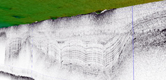
Above: Sub-bottom Sonar Data Used to Characterize the Degree of Impact to Ambient Sediments from Spoil Disposal
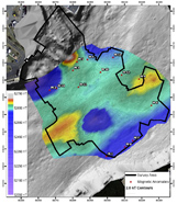
Left: Sub-Bottom Sonar Data to Map Organic Sediment Thickness
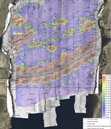
Right: Magnetometer Data to Map Buried Objects & Geological Features
Left: Magnetometer & Side Scan Data to Map Utilities & Debris
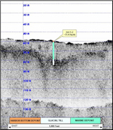
Right: Sub-Bottom Profile Data & Boring from Tide Generator Site


